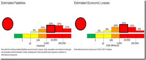
UPDATED 0700 hrs EST: The USGS has downgraded this quake to M7.8, but has revised their damage/fatality estimates upwards, with as many as 10,000 deaths possible. This is a rapidly evolving situation, and we are only now starting to get reports from the ground.
# 9978
Four years ago, in UNDP: Supercities At Seismic Risk, we looked at a United Nations Development Programme study that warned half of the world’s supercities (urban areas with 2 million – 15 million inhabitants) were at high risk of seismic activity. From their press release:
A significant number of very large cities with high population density such as Tokyo, Mexico City, Port-au-Prince, Istanbul or Kathmandu, many in developing countries with rapidly expanding population, are located near fault zones that have caused major earthquakes in the past – and most likely will again in the future.
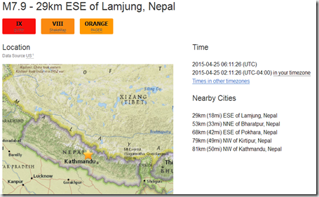
Over the past several hours Nepal has seen a cluster of a dozen strong earthquakes – topped off by an M7.9, and followed by an M6.6 – striking in the region Northwest of Kathmandu. Fortunately, the epicenter of the strongest quake was 50 miles from the heart of Kathmandu.
The USGS pager system, which generates likely damage based on location, magnitude, depth, and ground shaking, has estimated between 100 and 1,000 fatalities likely occurred. (See update above)
We’re just starting to get on-the-scene reports of damage and injuries, and those will be coming in for hours, if not days. Strong aftershocks may continue for weeks as well.
While Nepal is no stranger to strong quakes (M6.8 in 1988, 2011 M6.9 Sikkim Quake ) this is the strongest quake to strike the region since the M8.0+ 1934 Nepal-Bihar earthquake, which claimed at least 10,000 lives.
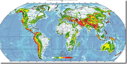
The deep reds in the USGS map below show the areas most at risk of seismic activity, and as you’ll see the boundary where Northern India and the Eurasian plate meet is one the more active regions of the world.

Seismically active areas of the world
Earthquakes strike without warning, and literally billions of people live on, or near seismic zones. Millions more live within range of earthquake driven tsunamis. The ground beneath one’s feet can violently shift in an instant, making it imperative that you, your family, and your business are prepared.
Working to improve earthquake awareness, preparation, and safety is Shakeout.org, which promotes yearly earthquake drills and education around the country (see NPM13: A Whole Lotta Shakeouts Going On). If you live in one of these seismically active areas, I would encourage you to take part in these yearly drills.
Every home should have no less than a 72-hour supply of emergency food and water, for all of its occupants (including pets!). This is a bare minimum, here in the United States many agencies and organizations recommend that households work towards having a 10-day supply of food, water, and emergency supplies on hand.
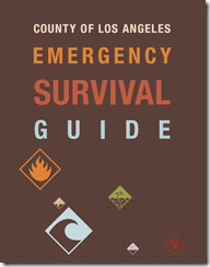
In When 72 Hours Isn’t Enough, I highlighted a colorful, easy-to-follow, 100 page `survival guide’ released by Los Angeles County, that covers everything from earthquake and tsunami preparedness, to getting ready for a pandemic.
While admittedly California-threat specific, this useful guide may be downloaded here (6.5 Mbyte PDF).
For more information on emergency preparedness, I would invite you to visit:
FEMA http://www.fema.gov/index.shtm
READY.GOV http://www.ready.gov/
AMERICAN RED CROSS http://www.redcross.org/
And some of my preparedness blogs, including:


